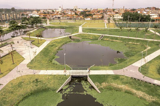
Walk along a river in almost any Latin American city and you will find stretches that have been straightened, lined with concrete, buried beneath roads, or pushed behind industrial areas and residential neighborhoods. Throughout the twentieth century, urban expansion gradually occupied riverbanks and former floodplains, while waterways were redirected or confined within infrastructure intended to control them. Yet the water continued to return. For decades, flooding has been the most frequent natural disaster in Latin America and the Caribbean, according to the Inter-American Development Bank.
Some cities have begun to reconsider what happens along these edges. Across Chile, Mexico, and Brazil, parks are being developed within riverbeds, drainage channels, and other territories exposed to flooding. These spaces accommodate water during heavy rainfall while providing areas for recreation, circulation, and gathering throughout much of the year. Their design also changes how surrounding neighborhoods access territories previously associated with flooding, pollution, or limited public use.
Reopening the City's Relationship with Water
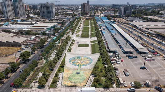
In Santiago, the Zanjón de la Aguada was once a boundary between different parts of the city. Rainwater, irrigation runoff, and sewage shared the same channel, while industry and informal settlements developed along its banks. For decades, recurring floods and pollution affected the surrounding neighborhoods, reinforcing the area's separation from the rest of the city.
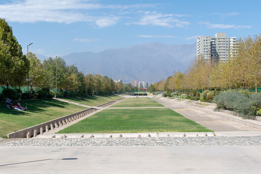
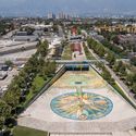
The Parque Inundable Víctor Jara, developed by Chile's Ministry of Public Works, is gradually transforming approximately 4.7 kilometers of this corridor into a linear park. Built in stages since 2013, it brings pedestrian and cycling paths, playgrounds, sports facilities, and green areas to neighborhoods that have historically had limited access to public space. The park retains its role in managing floodwater, incorporating recreational areas alongside drainage infrastructure. Later stages include water-retention areas, extending the possibilities for public use along the Zanjón.
Further north, in Copiapó, the relationship between the city and its river is shaped by a different condition. Located near the southern edge of the Atacama Desert, the Copiapó River can remain dry for extended periods, making its wide bed appear available for other uses. Yet occasional floods continue to affect its banks.
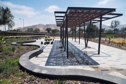
As the city expanded on both sides of the river, the riverbed became a barrier between neighborhoods. Aggregate extraction, mining waste, and debris disposal contributed to its deterioration, leaving a large stretch of centrally located land neglected and difficult to use.
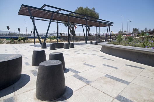
When Teodoro Fernández Arquitectos developed Kaukari Urban Park, the challenge was to accommodate the river's changing conditions while giving residents access to its banks. Fernández described the importance of learning to live with the river's veleidades, or unpredictable behavior.
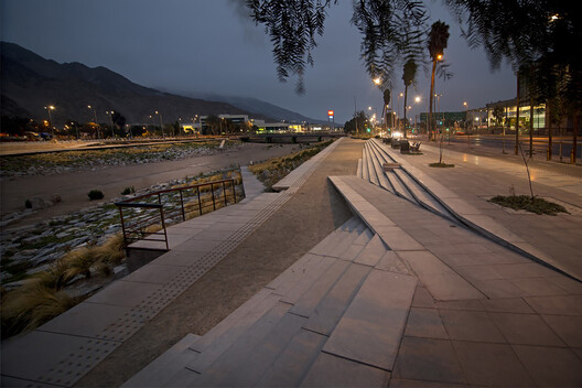
The design reorganizes the riverbed into areas that respond to different water levels. Lower ground remains available for the river and vegetation, intermediate terraces accommodate walking and gathering, and higher areas contain civic spaces, recreational facilities, and sports activities. During dry periods, residents can use parts of the river corridor while the landscape retains space for rising water.
The park also establishes connections between neighborhoods on opposite banks. Straight pedestrian paths extend the existing street layout along the northern side, while the southern bank follows a more irregular arrangement. What had long functioned as a physical division becomes part of the city's everyday circulation and public life.
A different relationship between water, landscape, and public use appears in Temuco, in southern Chile. Located between the Cautín River and the Pichicautín stream, Isla Cautín occupies land historically exposed to flooding. The 28-hectare Parque Urbano Isla Cautín, designed by Osvaldo Moreno and Martínez & Asociados, incorporates these conditions into a landscape that also responds to the cultural and social history of the site.
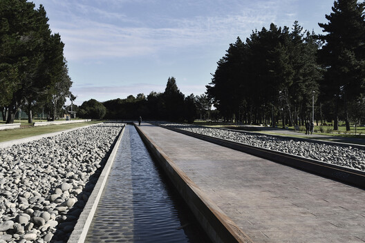
The park is organized around a large central meadow, with wetlands, channels, and planted areas that collect and absorb rainwater. A surrounding network of paths and public facilities accommodates sports, recreation, education, and cultural activities.
The intervention also gives particular attention to the communities connected to the territory. Its public programs include a ceremonial area for Mapuche traditions and a Human Rights Memorial associated with the site's history during Chile's military dictatorship. Water management becomes part of a larger public landscape where environmental restoration, cultural practices, and collective memory occupy the same territory.
Bringing Public Life into Flood-Prone Infrastructure
In other projects, architects work with existing infrastructure or land already designated to receive floodwater, introducing public activities into spaces that have traditionally served more limited functions.
In Nogales, near Mexico's border with the United States, an earthen dam built during the 1960s gradually became surrounded by housing. Some homes were constructed directly against its slopes, while wastewater collected in the reservoir and recurring floods threatened nearby residents. The dam continued managing runoff from the surrounding hills, but the neighborhood had few public facilities.
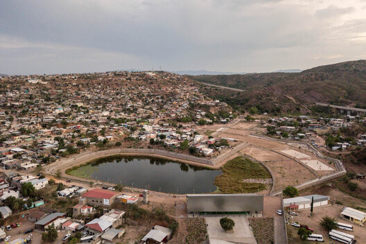
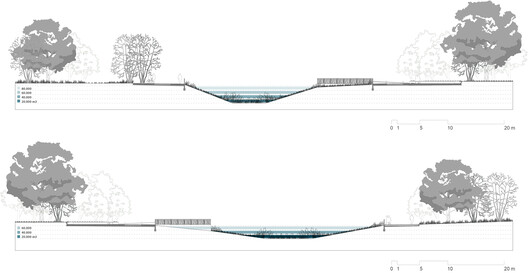
When Taller Capital, led by Loreta Castro Reguera and José Pablo Ambrosi, was commissioned to design a park beside the reservoir, the architects reconsidered the dam itself. Their Colosio Embankment Dam project introduces stepped terraces made of gabions (wire cages filled with stones) that stabilize the slopes and create pedestrian paths around the water.
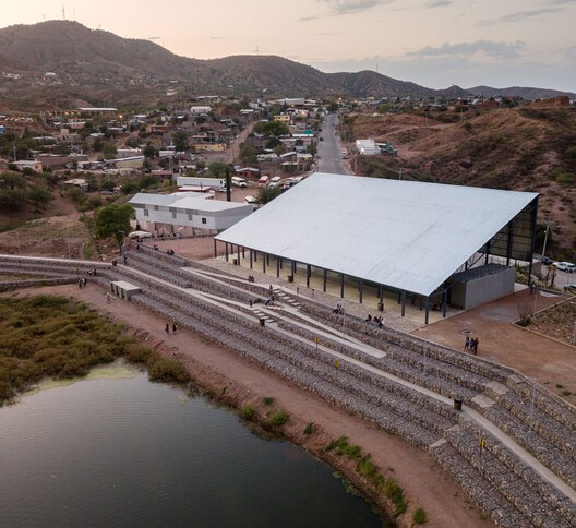
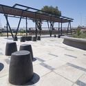
Platforms designed to accommodate flooding contain sports courts, gardens, and playgrounds. A triangular roof provides shade and a gathering place for residents while making the intervention visible from the nearby avenue.
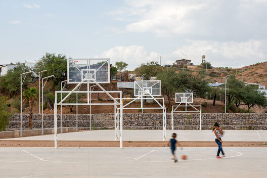
For the surrounding neighborhood, the dam becomes a place people can enter and use. The public facilities form part of the infrastructure itself, allowing recreation to occupy an area that continues to manage runoff during heavy rainfall.
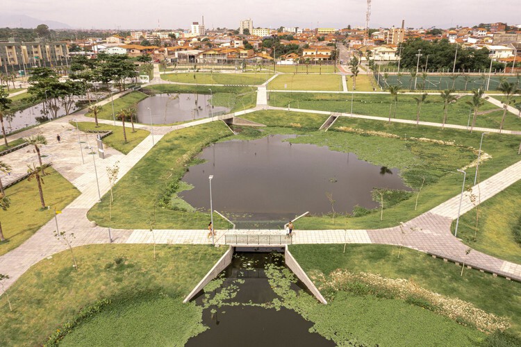
A similar concern with neglected urban land shaped Rachel de Queiroz Park in Fortaleza, Brazil. In the Presidente Kennedy neighborhood, the Cachoeirinha stream crossed an area affected by illegal dumping and wastewater pollution. As surrounding neighborhoods became more densely developed, the reduction of open ground also contributed to increasingly frequent flooding.
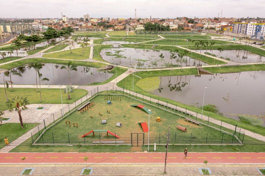
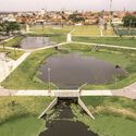
Designed by Architectus S/S, the park addresses these conditions through nine interconnected ponds that collect water from the stream and surrounding drainage systems. Aquatic vegetation helps filter pollutants, while the ponds provide additional space to hold water during heavy rainfall. The designers integrated this system into a public landscape with walking and cycling paths, sports facilities, playgrounds, and gathering areas.
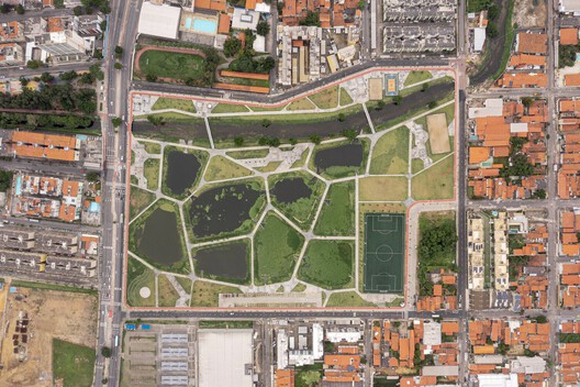
The intervention has also changed how people use the area. A site previously affected by pollution and informal waste disposal now accommodates daily recreation alongside the restored watercourse. The planted ponds have begun supporting local vegetation and wildlife, extending the park's contribution to the surrounding environment.
The Changing Role of Flood-Prone Land
These projects reconsider how cities occupy territories shaped by water. Areas previously associated with flooding, pollution, or restricted access now accommodate pedestrian routes, recreational facilities, and cultural activities, allowing surrounding communities to use spaces that had long remained disconnected from everyday urban life.
Their design also requires accepting that the conditions of these places will change. Different elevations, floodable surfaces, and water-retention systems allow public activities to take place within landscapes that continue to receive water during heavy rainfall. Maintaining these spaces and managing their changing use become part of their long-term operation.
As cities continue to expand along rivers and flood-prone territories, these interventions raise questions about how much land should remain available for water and how it can be used between flood events. They also show how architecture can extend the public value of these territories, bringing new activities and connections to places historically defined by their environmental constraints.
This article is part of the ArchDaily Topic: The Architecture of Water: Territories, Tensions & Transformations. Every month we explore a topic in-depth through articles, interviews, news, and architecture projects. We invite you to learn more about our ArchDaily Topics. And, as always, at ArchDaily we welcome the contributions of our readers; if you want to submit an article or project,contact us.