A different social order is easier to imagine when it sits far from the one that already exists. In Latin America, that distance has often been territorial. Parts of the region have repeatedly been treated as places where another world could begin. These places were never empty.
For architects, this idea has a familiar starting point: the plan. Seen from above, a territory can look like a clean sheet, ready for an axis or a grid. At eye level, the same ground is already full of people and the paths they use.
Long before modern planning, El Dorado had already turned part of South America into an imagined territory. The story grew from Muisca rituals at Lake Guatavita, in present-day Colombia, where offerings were made to the water. Spanish chroniclers transformed these practices into stories of a gilded ruler and extraordinary wealth. Over time, El Dorado stopped referring to a person and became the name of a place, a city of gold imagined somewhere beyond the known map.
Related Article
Brasília: A Social ArchitectureA specific place had become defined by what outsiders expected to find there. In the twentieth century, similar ideas began to take physical form through architecture and planning.
Importing an American Model to the Amazon
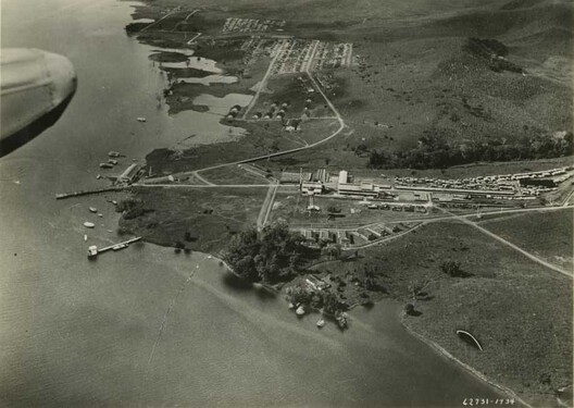
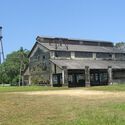
Fordlândia was planned thousands of miles from where it was built. In the late 1920s, Henry Ford set out to produce his own rubber on the Tapajós River, in the Brazilian Amazon, and to build a town around the plantation. From Michigan, he imagined a small American town rebuilt in the rainforest and run the Michigan way, down to square dances and a ban on alcohol.
The town took that image literally. Workers' bungalows lined up near the river dock, much like a mill town in the United States, and a steel water tower rose above them, its whistle marking the hours of work. The houses were designed in Michigan and shipped to Brazil, with metal roofs chosen over local thatch that trapped heat under the equatorial sun.
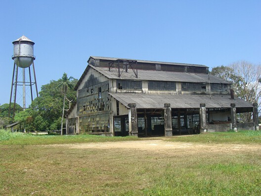
Daily routines followed the same model. Workers punched time clocks and ate American food in a company dining hall. Historian Greg Grandin, in his book Fordlandia, describes the project as an attempt to export an entire way of life.
The model did not hold. Rubber trees planted in dense rows were devastated by blight, and in December 1930 a protest over the dining hall turned into a riot that sent managers fleeing to boats on the river. Ford had imagined a small town that could be rebuilt anywhere. The Amazon and the people working there proved otherwise.
Building a New Capital in Brazil's Interior
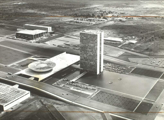
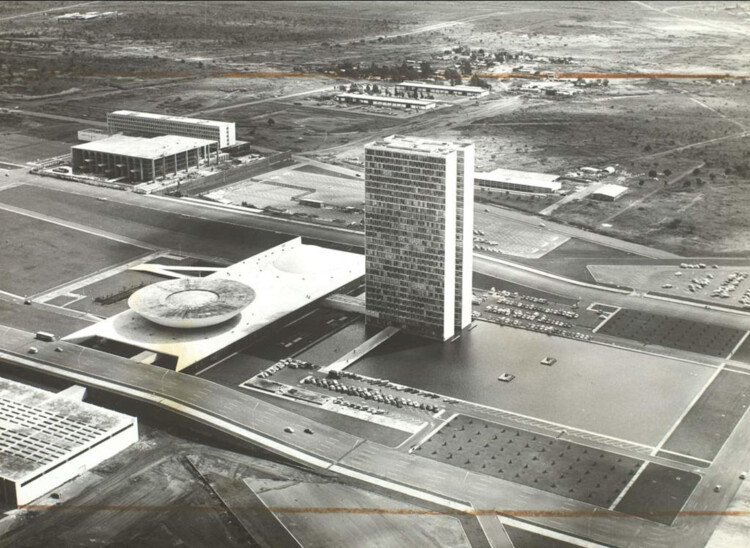
Brasília was conceived as a new capital for Brazil, built inland as part of President Juscelino Kubitschek's national modernization project. The move was meant to mark a break with the coastal capitals that had governed the country since colonial times. Lúcio Costa won the 1957 competition for its urban plan, and by 1960 the city stood on the central plateau.
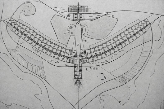
Costa's plan began with a single gesture. In his competition report, he described the Plano Piloto as born from the act of someone marking a place or claiming it as their own, which he drew as "two axes crossing at right angles, that is, the very sign of the cross." He tied that gesture directly to the colonial tradition. Four centuries after El Dorado, the founding of a modern capital still borrowed the logic of claiming land.
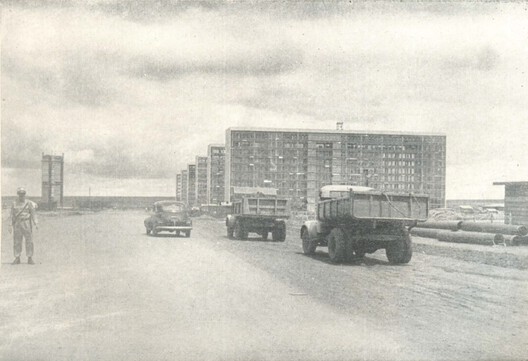
Those two axes organized almost the entire city. The curved Residential Axis contained the superquadras, housing blocks raised on pilotis and surrounded by shared green space. The Monumental Axis concentrated government and civic buildings, including some of Oscar Niemeyer's best-known projects. The result was a city of wide distances and open ground, laid out as if the plateau had been empty.
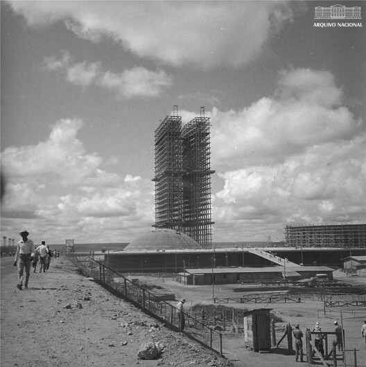
Constructing the new capital required tens of thousands of workers, known as candangos, many of whom came from Brazil's Northeast. They lived in construction camps and in the Cidade Livre, a settlement intended to disappear once the capital was completed.
Few of them found a place in the city they had built. While the superquadras became the model of housing for the new capital, many workers were moved to satellite towns such as Taguatinga, created for residents removed from an informal settlement, and later Ceilândia, founded in 1971 for the same purpose. Today, the protected Plano Piloto sits at the center of a much larger metropolitan territory and houses less than a tenth of the Federal District's population.
Planning a New Industrial City in Venezuela
Ciudad Guayana was created in southeastern Venezuela in the early 1960s to turn the region's iron deposits and hydroelectric power into a new industrial center, where the Orinoco and Caroní rivers meet. The Corporación Venezolana de Guayana worked with the Joint Center for Urban Studies of MIT and Harvard to plan the new city. For the planners, it offered something rare: the chance to design an entire city at once.
The plan drew Ciudad Guayana as a linear city. Avenida Guayana was intended to work as its spine, connecting industrial areas to commercial centers and housing. Researchers have since described the project as an urban laboratory, where planning ideas could be tested at the scale of a whole city.
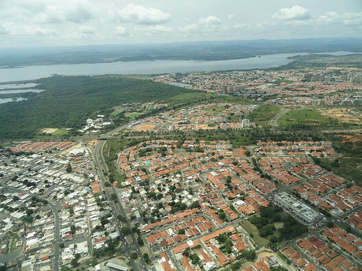
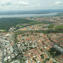
The site, however, was already inhabited. On the west bank of the Caroní stood Puerto Ordaz, a company town for an American iron mining firm, designed by Josep Lluís Sert, one of the leading figures of CIAM. On the east bank was San Félix, originally a fishing village, where most newcomers settled. By 1962, around 20,000 people were living in self-built settlements in a city that was still being drawn.
The plan placed new housing near the industries in the west, yet most people continued to settle around San Félix. And while the planners hoped for socially mixed neighborhoods, Puerto Ordaz filled with middle- and upper-income residents.
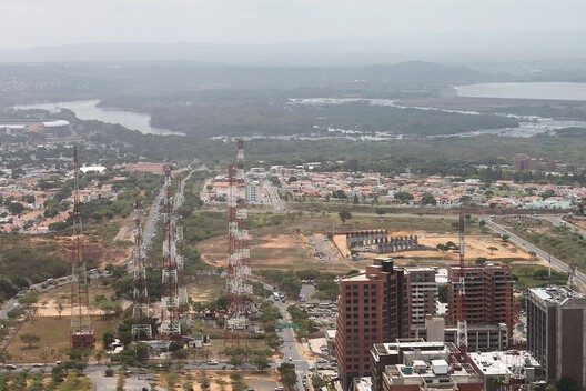
That difference also appeared in the way people understood the city. Donald Appleyard, an urban designer with the Joint Center, asked residents to draw maps of Ciudad Guayana and compared them with the planners' drawings. The official plan organized the city as a complete system, while residents mapped the routes and places they actually used. Their maps revealed parts of urban life that were difficult to see in the masterplan itself.
What Happens Beyond the Plan
Fordlândia, Brasília, and Ciudad Guayana came from different moments and political projects. Each began with the same hope: that moving elsewhere would make it possible to organize society from the start. The plan made that hope feel achievable. Seen from above, a large and complicated place could be drawn and reorganized as if nothing were already there.
What happened afterwards was less controlled. Fordlândia confronted a climate and a way of life very different from the model it imported. Brasília grew far beyond the boundaries of the Plano Piloto. Ciudad Guayana developed through neighborhoods and daily routes that the planners' version of the city did not capture.
The appeal of beginning again elsewhere depends on how a territory is read before construction starts. That reading is rarely shared by the people who already live there. Who gets to decide what a place is, and what remains outside that decision?
This article is part of the ArchDaily Topic: The Lure of Escapism in Architecture and Alternative Worlds. Every month we explore a topic in-depth through articles, interviews, news, and architecture projects. We invite you to learn more about our ArchDaily Topics. And, as always, at ArchDaily we welcome the contributions of our readers; if you want to submit an article or project, contact us.