When the Ostrogoths besieged Rome in 537 AD, their first military act was to cut the aqueducts. Eleven gravity-fed channels supplied the city with up to a million cubic meters of water per day, more than enough to sustain a population of over a million, fill the public baths, and scour the sewers. Without the aqueducts, Rome became a fortified enclosure around a contaminated river, proving that water was essential to the city's existence.
Unlike land, which can be fenced off, or oil, which can be stored, water is a resource that nobody can fully own, yet everyone depends on. It moves through aquifers, across borders, and down rivers. The Romans were cognizant of this fact; as the aqueducts constituted public infrastructure, the water flowing into fountains was accessible to all. Frontinus, the administrator who oversaw Rome's water system in the first century AD, documented every allocation, every illegal connection, and every abuse of the system with the rigor of someone who understood that water management was a civic act. Architecture, in this sense, has always had the capacity to make water a common good, and equally, by the same means, a privilege.
Upstream and downstream are positions in a watershed that determine, with the precision of topography, who absorbs the consequences of decisions made. Architecture has always known how to work with gravity; what it has been slower to acknowledge is that gravity is, also, political.
Related Article
Unearthing the Ground: Architecture and the Politics of WasteThe Dam
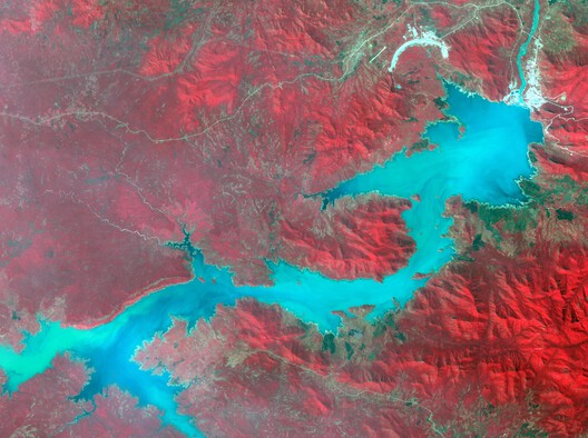
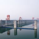
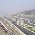
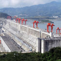
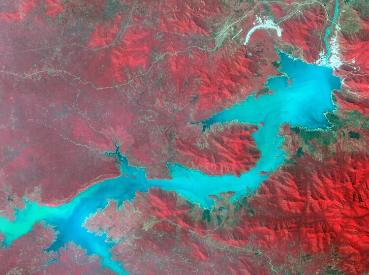
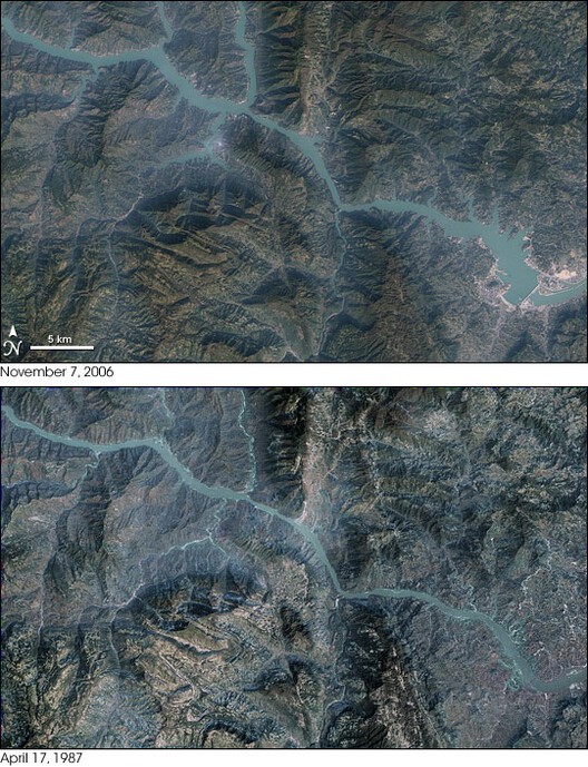
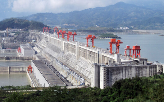
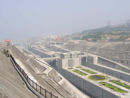
In 1997, Jiang Zemin, the fourth paramount leader of China, presided over the ceremony marking the completion of the Yangtze River diversion. Jiang is reported to have said that "man must conquer nature," a motto that came to stand for the project. The main wall was completed in 2006, is 2.3 kilometers long and about 181 meters tall, and the reservoir took years to fill. By the time it reached its final height in 2010, it had submerged 13 cities, 140 towns, and 1,350 villages, along with more than 1,300 known archaeological sites.
The Three Gorges Dam is the largest hydroelectric project ever built, and also the largest resettlement project in history. The dam generates enough electricity to supply a significant portion of China's eastern seaboard. But at the cost of that generation, 1.3 million people were resettled along the reservoir's edge, among farming communities in Chongqing and Hubei whose land disappeared underwater, whose replacement plots on the steep hillsides above the waterline were too eroded to cultivate, and whose promised compensation was frequently absorbed. The project protected some 15 million people downstream from catastrophic flooding while displacing over a million upstream.
This is the architecture of the dam, not the engineering of its face or the spectacle of its spillways, but the territorial logic it enacts. Every impoundment creates a geography of beneficiaries and a geography of renunciation. The dam does not distribute its consequences according to need or merit but according to position in the landscape, which is to say according to existing power. Architecture is not an aesthetic vessel but an apparatus that organizes and hierarchizes bodies in space, and the dam is among the most explicit examples of that hierarchy. The history of modern architecture is full of admiration for large hydraulic infrastructure, the precision of its engineering, the scale of its ambition, and the image of civilization imposed on natural systems. But what is consistently omitted is the other side of the reservoir, the disappearing towns, the arable land, the displaced communities. Architecture, like any discipline, produces its objects through the questions it chooses to ask; when it asks how a dam stands, how its spillways perform, how its mass meets the landscape, it is also choosing not to ask what the landscape was before, and whose it was. Hydrology has models for sediment displacement; ecology has frameworks for habitat loss; displacement studies have methodologies for tracking resettled populations. Architecture, which claims the organization of space as its core competence, has so far known what it erases without learning how to work with what remains.
The Aswan High Dam, completed in Egypt in 1970, displaced an estimated 100,000 Nubians from their ancestral territory along the Nile; something described as epistemic, erasing a culture that had already survived one previous displacement by the Aswan Low Dam, built by British colonialists in 1902. The dam was Egypt's symbol of postcolonial modernity and industrialization; the Nubians who lost their villages to its reservoir were, in this sense, the cost of someone else's progress.
The Grand Ethiopian Renaissance Dam on the Blue Nile reopens that history from the other side. When Ethiopia began construction in 2011, it broke a water allocation framework that had stood since the colonial era, a 1929 treaty (renegotiated in 1959) that guaranteed Egypt an annual supply of 55.5 billion cubic meters of Nile water and gave Cairo effective veto power over any upstream infrastructure project. The treaty was signed without Ethiopia's participation and allocated, between Egypt and Sudan, the entirety of a river whose largest tributary (the Blue Nile, contributing roughly 85 percent of the Nile's total flow) originates in the Ethiopian highlands. Despite supplying most of the water, Ethiopia was entitled to use less than one percent of it. The colonial framework had, in effect, built a legal structure that controlled the river's benefits as surely as any physical impoundment.
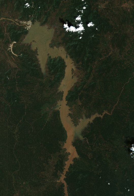
The GERD, now the largest dam in Africa, represents Ethiopia's assertion that this arrangement was a colonial artifact. Egypt responds that the dam constitutes an existential threat to its water security, as 98 percent of its renewable water resources come from the Nile. Without a guaranteed minimum annual flow, agriculture and electricity generation would both fail. Two irreconcilable claims about the same river, both grounded in genuine need. Unlike the communities displaced by the Three Gorges, who were at least nominally subjects of the state that displaced them, eligible for compensation however poorly administered, Egypt has no legal mechanism to compel a sovereign upstream neighbor.
Day Zero
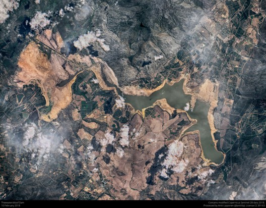
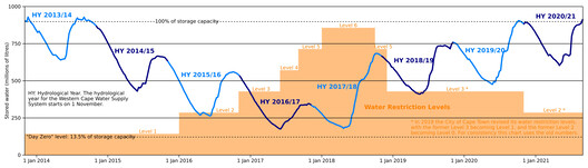
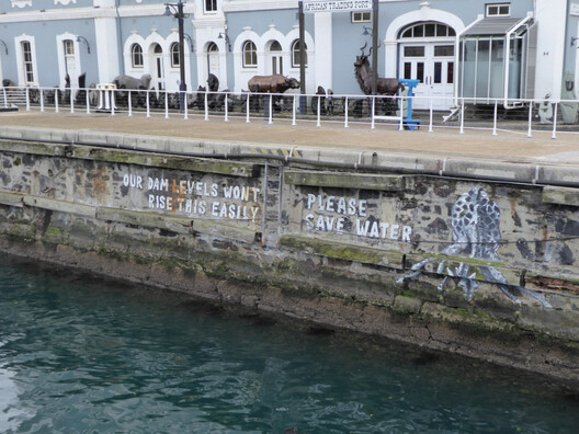
In January 2018, the city of Cape Town announced that it was approaching a point when dam levels would fall below 13.5 percent of capacity, and the municipality would be forced to shut off taps to most of the city's 3.7 million residents. The Day Zero announcement made international headlines as evidence of a new kind of urban catastrophe: a major city in the modern era on the verge of running out of water. By July, strong winter rains had pushed dam levels back above 50 percent, and the crisis was declared over.
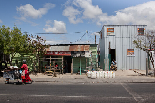
Across cities in the Global South, water infrastructure was designed for populations smaller, less dense, and distributed according to colonial planning logics that reserved formal services for some neighborhoods and withheld them from others. When those cities grew informally, they absorbed millions of residents into settlements that accumulated on the periphery. The infrastructure did not expand to meet this new condition; without water pressure, without metered connections, without the redundancy that makes a system resilient. By 2018, the informal settlements of Khayelitsha and Mitchell's Plain were receiving water through communal standpipes delivering less than 25 liters per person per day (the Day Zero ration the city was proposing as an emergency measure for the formal city).
During apartheid, water and sanitation services were divided across 25 separate municipalities, each serving a racially designated population; the townships received what remained after white residential areas had been supplied, and the pipes that reached them were poorly maintained by design. When apartheid ended in 1994, the physical infrastructure did not disappear. By 2018, formal households consumed 66 percent of the city's water supply. The informal settlements, where 14 percent of Cape Town's households lived, used 4 percent. The restrictions that arrived with the drought fell equally on a household using 300 liters a day and a household already using 30.
The anthropologist Nikhil Anand, studying Mumbai's water infrastructure, called this condition hydraulic citizenship, the capacity of residents to be recognized by city agencies through legitimate water connections. Those who are not connected are not simply underserved; they are, in the administrative logic of the municipality, not yet fully urban. The geographer Erik Swyngedouw, working across Guayaquil and other cities in the Global South, argues that water does not flow according to need but through networks of power, technology, and meaning, making scarcity a socially produced condition. In Guayaquil, where 600,000 people lacked easy access to potable water while the city sat on abundant resources, poor neighborhoods relied on private tanker trucks charging prices that consumed a disproportionate share of household income. The struggle for water in cities like Guayaquil or Cape Town is, in Swyngedouw's terms, not just for the right to water but for the right to the city itself.
The Border
The political theorist Stuart Elden argues that we have been thinking about territory in the wrong dimension; as area rather than volume, as a flat surface to be divided rather than a three-dimensional space that extends above and below the ground, into the sub-soil and the sub-marine. China is doing exactly that in the South China Sea, as it is not claiming a line on a map but constructing a volume; dredging material from the seabed, raising it above the surface, and then asserting that the column of space above it, and the water around it, now belongs to a different political jurisdiction. The United Nations Convention on the Law of the Sea (UNCLOS) was written for a world of surfaces. The artificial island operates in depth. Modern territorial law, including the legal architecture of the sea, was built on the assumption of surface (the line on the map, the continental shelf). But what is missing is depth; the political control over what lies above and below simultaneously.
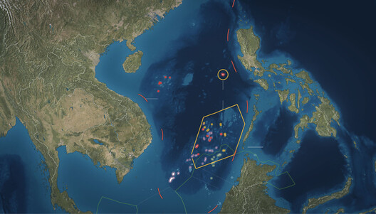
Between December 2013 and October 2015, China dredged sand and coral from the seabed of the Spratly Islands and deposited it on seven submerged reefs, creating close to 3,000 acres of new land. What China built was not, in Elden's terms, a surface but a volume. It extracted material from the seabed, raised it above the waterline, and then asserted that the column of water and airspace surrounding it now fell within a different political jurisdiction. The legal frameworks governing the sea were written for a world of surfaces; the artificial island operates in depth, manufacturing the ground on which its claims would stand from the ground that was beneath the water. China's Ministry of Foreign Affairs described the construction as aimed at optimizing functions and improving living and working conditions.
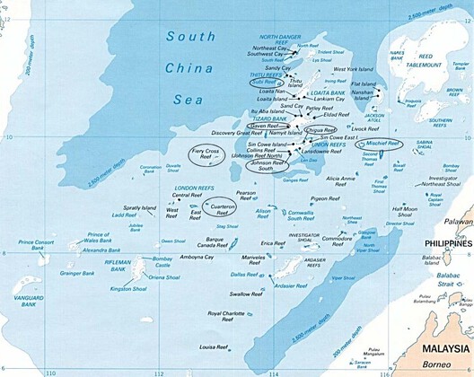
Under UNCLOS, artificial islands generate no territorial sea of their own. The 2016 arbitral tribunal ruling, brought by the Philippines, found that China's nine-dash line claim had no legal basis, and that China had violated the Philippines' sovereign rights. But the pattern is consistent: build first, dispute later, and rely on the fact that no enforcement mechanism exists capable of removing what has already been constructed. Water, across all the cases in this article, has been directed, contained, rationed, and manufactured into territory by infrastructure. The architecture is irreversible in a way that the legal argument is not, which is precisely the point.
This article is part of the ArchDaily Topic: The Architecture of Water: Territories, Tensions & Transformations. Every month we explore a topic in-depth through articles, interviews, news, and architecture projects. We invite you to learn more about our ArchDaily Topics. And, as always, at ArchDaily we welcome the contributions of our readers; if you want to submit an article or project, contact us.


