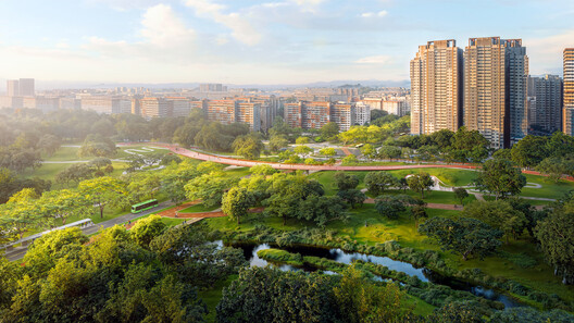
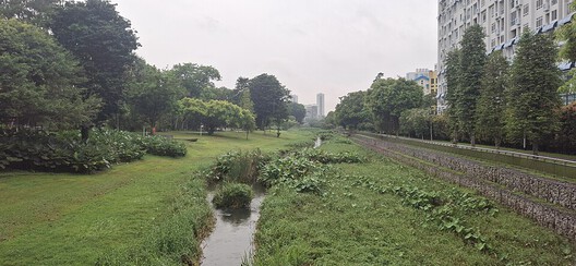
At Bishan–Ang Mo Kio Park in Singapore, a river does not occupy a fixed boundary. Under ordinary conditions, water moves through a naturalized channel bordered by grass, planting, and paths that bring visitors close to the river. During heavy rainfall, water spreads into the surrounding park, which is designed to accommodate flows beyond the capacity of the narrower channel. What appears to be a public landscape is also working infrastructure. Singapore's approach retains drainage engineering while assigning a wider role to the land around it.
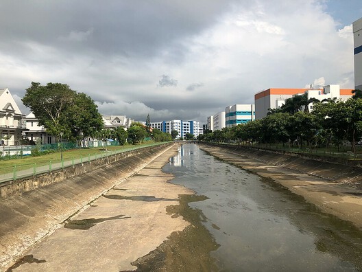
For decades, Singapore's network of concrete canals has been central to managing stormwater in a densely developed city exposed to intense tropical rainfall. Their hard surfaces and defined channels were designed to convey water efficiently. These channels moved stormwater efficiently, but offered limited space for public access, planting, or other uses along the water's edge. Through its Active, Beautiful, Clean Waters (ABC Waters) Programme, launched in 2006, Singapore began integrating waterways with parks, ecological systems, and public spaces. The programme links stormwater management with the design of parks, waterways, and public spaces.
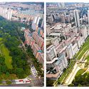
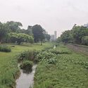
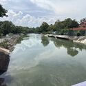
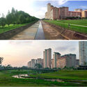
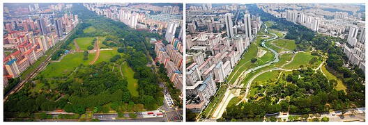
The transformation of the Kallang River at Bishan–Ang Mo Kio Park offers one of the clearest examples of this approach. A 2.7-kilometer stretch of the former concrete canal was redesigned as a naturalized river, bringing the waterway into the surrounding park. The central design decision was to allow the park to function as a flood conveyance area. Under normal conditions, water occupies a narrower stream. During heavy rainfall, the flow can expand into the adjacent landscape. The park's ground is part of the flood conveyance system, not just the public space around it. Soil bioengineering and naturalized banks support this arrangement, combining hydraulic requirements with a more varied river edge.
Related Article
Rivers Before Roads: How Southeast Asia's Waterways Produced an Alternative Urbanism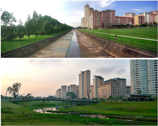
At Bishan, the naturalized banks allow visitors to approach the water more closely. Compared with the former concrete canal, the naturalized river introduces gentler banks and stepping stones along the water's edge. PUB documents the park's dual role as a recreational landscape and a flood conveyance area. Sungei Tampines shows how naturalized banks can be introduced alongside measures to increase a canal's stormwater capacity.
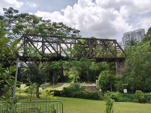
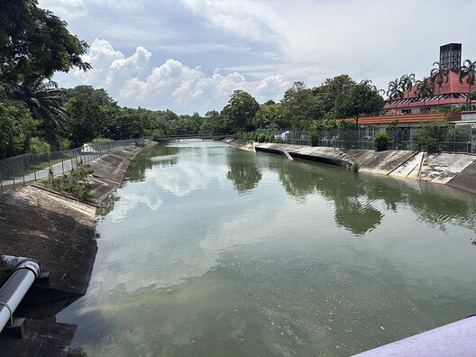
In 2022, drainage improvements along a 1.4-kilometer section included widening the waterway by up to 4.5 metres and deepening it by 0.5 metres. These interventions increased its stormwater conveyance capacity by a reported 30 per cent. Approximately one kilometer of one bank was also naturalized using soil bioengineering techniques. A cantilevered park connector, lookout decks, and a bridge provide public access along the waterway.
A canal can be widened and deepened while sections of its banks are naturalized. The widened channel conveys stormwater, while selected sections of its banks accommodate planting, habitat, and public access. At Sungei Tampines, naturalisation is limited to sections of the bank while the main channel is enlarged to carry more stormwater. Channel dimensions, bank stability, water levels, and maintenance requirements continue to determine how these spaces operate.
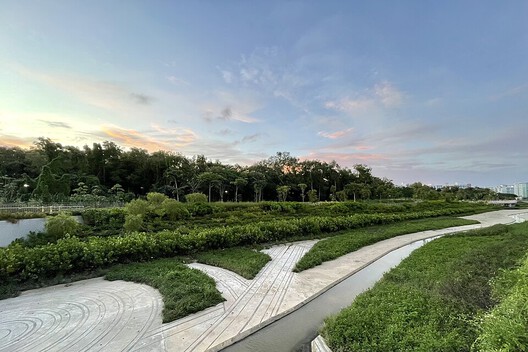
At Sungei Ulu Pandan, the landscape also treats runoff before it reaches the canal. Here, the design incorporates features intended to treat runoff before it enters the waterway, making the landscape an active part of the drainage system rather than simply its visible setting. PUB's project documentation describes vegetated swales, sedimentation basins, cleansing biotopes, and habitat cells as components of this approach. Swales guide runoff while helping remove larger sediments. Sedimentation basins allow suspended particles to settle, while cleansing biotopes use plants and soil media to filter pollutants and absorb nutrients. Shallow, planted habitat cells along the canal edges provide shelter and feeding opportunities for wildlife.
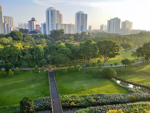
The interventions were implemented in phases. An initial 600-metre section was completed in 2013, followed by works along a further 1.9 kilometers, completed in 2022. The phased works combined drainage improvements with runoff treatment and habitat features along the canal. The presence of these features alone does not establish their environmental performance. Research evaluating Singapore's ABC Waters Programme has found that some interventions perform well in removing suspended particles, while nutrient removal has been less consistent. Treatment performance varies with site conditions, including the characteristics of incoming runoff and the operation and maintenance of individual features.
At Bishan–Ang Mo Kio Park, the river forms part of a larger recreational landscape. At Sungei Tampines, bridges, lookout decks, and a park connector establish points of access along a more linear drainage corridor. In both projects, access is provided along waterways that continue to serve drainage functions. When a canal is accessible from everyday routes, it can become part of how residents experience their neighborhood. Paths, bridges, and places to stop along the water's edge allow residents to encounter the canal as part of everyday public space.
Research on the non-market value of Singapore's ABC Waters Programme found that residents valued its environmental and amenity features, although preferences varied between groups. They do not, however, establish that every project increases social interaction or provides equal access to public space. Those outcomes depend on how spaces are connected, maintained, and used by different communities.
Public access must be maintained alongside the operational requirements of the waterway. These landscapes must accommodate fluctuating water levels and intense rainfall, while planted and engineered systems require ongoing maintenance. Paths and public amenities must therefore remain compatible with changing water levels and flood conditions.
Bishan–Ang Mo Kio Park, Sungei Tampines, and Sungei Ulu Pandan extend the role of drainage infrastructure in different ways. One integrates the river with a floodable park; another combines increased conveyance capacity with naturalized banks and public access; the third incorporates runoff treatment and habitat features into the waterway's landscape. Across the three projects, drainage remains the primary hydraulic function, while the surrounding landscape also provides flood storage, runoff treatment, habitat, or public access.
The long-term performance of the ABC Waters Programme depends on how its projects are monitored and maintained after completion. Monitoring is needed to assess environmental performance, while ecological features require maintenance. The benefits of public access also need to be evaluated through how people use these spaces. A greener canal is not, by itself, proof of improved water quality, restored biodiversity, or reduced flood damage. These outcomes must be established through evidence over time.
Singapore's waterways show why drainage infrastructure needs to be evaluated beyond its hydraulic capacity. Hydraulic capacity and the appearance of a natural river are insufficient measures of a waterway's performance. The surrounding landscape can provide space for floodwater, habitat for other species, and public access to the waterway. The canal remains a drain. Its banks and surrounding ground determine how much more the waterway can do.
This article is part of the ArchDaily Topic: The Architecture of Water: Territories, Tensions & Transformations. Every month we explore a topic in-depth through articles, interviews, news, and architecture projects. We invite you to learn more about our ArchDaily Topics. And, as always, at ArchDaily we welcome the contributions of our readers; if you want to submit an article or project, contact us.