1. ArchDaily
  2. Urban Mobility

Urban Mobility: The Latest Architecture and News

When Mobility Becomes the Ground: Architecture, Adaptation, and the Search for Continuity

Audio available

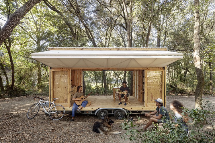
Few conditions have shaped contemporary architectural discourse as profoundly as uncertainty. Across international biennials, exhibitions, and forums, architecture increasingly imagines its relationship to the world through flexibility, reversibility, and responsiveness—qualities intended to engage with climate emergencies, political instability, and unprecedented human mobility. Buildings are designed to transform, infrastructures to evolve, and cities to accommodate conditions that appear increasingly unpredictable. This emphasis on agility has expanded the discipline's capacity to engage with environmental change, offering valuable strategies for a world in constant transformation.

Yet this evolution points to a deeper shift in how architecture mediates the human condition. Architecture has long functioned as a mechanism for existential orientation—a way for human consciousness to carve an intelligible coordinate out of an indifferent cosmos, anchoring memory and identity to a fixed point. Within much contemporary architectural discourse, uncertainty increasingly appears less as an external condition to be mitigated than as the horizon from which architectural thinking begins. Spatial experience is increasingly shaped by environments designed around the persistence of flux, where static reference points give way to conditions of continuous transformation.

When Mobility Becomes the Ground: Architecture, Adaptation, and the Search for Continuity - Imagem 1 de 4When Mobility Becomes the Ground: Architecture, Adaptation, and the Search for Continuity - Imagem 2 de 4When Mobility Becomes the Ground: Architecture, Adaptation, and the Search for Continuity - Imagem 3 de 4When Mobility Becomes the Ground: Architecture, Adaptation, and the Search for Continuity - Imagem 4 de 4When Mobility Becomes the Ground: Architecture, Adaptation, and the Search for Continuity - More Images+ 5

Movement, Innovation, and Memory: The Bizkaia Bridge Between Engineering and Heritage

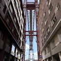
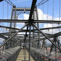
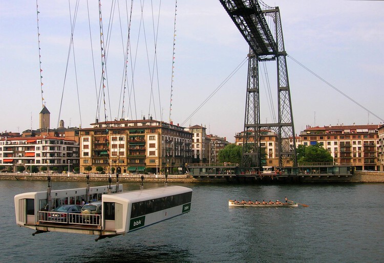
What role do transportation infrastructures play in shaping the culture and economy of societies? How do they bridge cultural, ideological, and geographic divides while transforming the lives of the communities they serve? One of the most remarkable iron structures of the European Industrial Revolution stands west of Bilbao, spanning the Nervión River at the mouth of the Ibaizabal Estuary. It is the Bizkaia Bridge, which combines nineteenth-century ironworking traditions with the innovative use of lightweight alternating-twist steel cables. Recognized as the world's first transporter bridge, it became a model for similar structures built throughout Europe, Africa, and the Americas.

Constructed to connect the opposite banks of the Nervión estuary, it was the first bridge in the world to allow ships, passengers, and vehicles to cross simultaneously by means of a suspended gondola. This innovative system improved communication between two small seaside resort towns while allowing uninterrupted navigation through one of Europe's busiest inland ports.

Movement, Innovation, and Memory: The Bizkaia Bridge Between Engineering and Heritage - Image 1 of 4Movement, Innovation, and Memory: The Bizkaia Bridge Between Engineering and Heritage - Image 2 of 4Movement, Innovation, and Memory: The Bizkaia Bridge Between Engineering and Heritage - Image 3 of 4Movement, Innovation, and Memory: The Bizkaia Bridge Between Engineering and Heritage - Image 4 of 4Movement, Innovation, and Memory: The Bizkaia Bridge Between Engineering and Heritage - More Images+ 3

The Metrics We Use Decide the Cities We Build: Urban Indicators and Lived Experience

Subscriber Access | 
Audio available

Modern cities are running on performance indicators. They move millions of people each day, concentrate capital, separate land uses, and sustain complex systems of logistics and consumption. In that sense, the city functions as a system to be continually adjusted and optimized.

Today's dominant metrics are familiar and widely witnessed: vehicles per hour, average commute times, floor area ratios, parking turnover, housing starts, and tax revenue per parcel of land. These figures describe a city that is legible through efficiency. They are inherited from an industrial logic, where urban space is treated more like a production mechanism than a lived-in environment. In this framing, cities begin to mimic the needs and metrics of a machine.

The Metrics We Use Decide the Cities We Build: Urban Indicators and Lived Experience - Image 1 of 4The Metrics We Use Decide the Cities We Build: Urban Indicators and Lived Experience - Image 2 of 4The Metrics We Use Decide the Cities We Build: Urban Indicators and Lived Experience - Image 3 of 4The Metrics We Use Decide the Cities We Build: Urban Indicators and Lived Experience - Image 4 of 4The Metrics We Use Decide the Cities We Build: Urban Indicators and Lived Experience - More Images+ 2

UNS and Settanta7 Selected to Design Turin Metro Line 2 as a 32-Station Network

Audio available

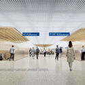
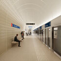
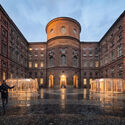
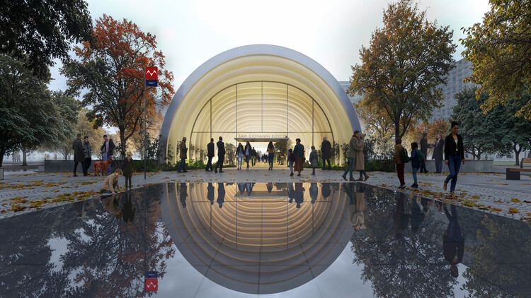
UNS's design proposal for Turin's new Metro Line 2, developed in collaboration with Settanta7, Mijksenaar, Frigorosso, 3BA, and WSP, has been selected by an international jury of experts chaired by Dominique Perrault. The proposal is based on the idea of "flow," a concept that has historically shaped the Italian city, from the Po and Dora rivers to the 18 kilometers of arcaded porticoes that structure how residents and visitors move. The project envisions Line 2 as a new "urban river," guided by three design principles to facilitate this flow: branding, transit experience, and scales of identity. With 32 stations planned in total, the initial design phase includes 10 stations, among them Mole Giardini, San Giovanni Bosco, and Carlo Alberto.

UNS and Settanta7 Selected to Design Turin Metro Line 2 as a 32-Station Network - Image 1 of 4UNS and Settanta7 Selected to Design Turin Metro Line 2 as a 32-Station Network - Image 2 of 4UNS and Settanta7 Selected to Design Turin Metro Line 2 as a 32-Station Network - Image 3 of 4UNS and Settanta7 Selected to Design Turin Metro Line 2 as a 32-Station Network - Image 4 of 4UNS and Settanta7 Selected to Design Turin Metro Line 2 as a 32-Station Network - More Images+ 1

Jahad Metro Plaza in Tehran: Reclaiming Infrastructure as Civic Space

Subscriber Access | 
Audio available

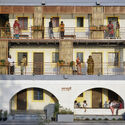
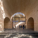
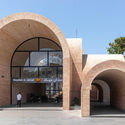
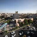
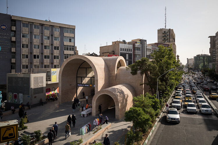
In Iran's capital, Tehran, movement defines the city. Each day, millions navigate a landscape shaped by highways, traffic corridors, and dense urban blocks. Over decades of rapid expansion, infrastructure has become the dominant language of development. Streets prioritize vehicles, sidewalks function as narrow conduits, and many public spaces operate primarily as passages rather than places of gathering. Across parts of West Asia, ongoing conflict has also reshaped the region's urban landscapes, where significant architectural environments have been damaged or transformed. Within this broader context, the preservation and creation of everyday civic space becomes increasingly meaningful. Recognized with the Aga Khan Award for Architecture, the Jahad Metro Plaza project, designed by KA Architecture Studio, demonstrates how modest infrastructural interventions can reshape the civic life of a city.

The metro network plays a central role in Tehran's daily life. It connects distant districts and sustains the rhythms of the metropolis. Yet the places where the underground city meets the surface are rarely conceived as civic environments. Metro entrances typically appear as fragments of infrastructure: stairs descending below ground, surrounded by railings, kiosks, and improvised circulation paths. They function efficiently as thresholds, but seldom as places to remain.

Jahad Metro Plaza in Tehran: Reclaiming Infrastructure as Civic Space - Image 1 of 4Jahad Metro Plaza in Tehran: Reclaiming Infrastructure as Civic Space - Image 2 of 4Jahad Metro Plaza in Tehran: Reclaiming Infrastructure as Civic Space - Image 3 of 4Jahad Metro Plaza in Tehran: Reclaiming Infrastructure as Civic Space - Image 4 of 4Jahad Metro Plaza in Tehran: Reclaiming Infrastructure as Civic Space - More Images+ 10

Endangered Heritage in Southwest Asia and Global Transport Infrastructure Projects: This Week’s Review

Audio available

This week has been marked by the deliberate, rampant, and unjust destruction of war in Southeast Asia. As one of the most damaging manifestations of human abuse of power, we have witnessed the destruction of places that hold memories and sustain culture, as well as the loss and irreparable harm to the human lives that lend them their identity. With the expectation of offering brighter and more constructive scenarios in the future, we present, in contrast to this reality, a scenario of progress in the gender gap that characterizes architecture and its paths forward, a group of landmark projects of public and community interest moving forward from Türkiye to Mexico, and three major multimodal transport infrastructure projects improving the way we circulate and inhabit public space in Europe and the United States.

Mobility Justice: Urban Equity in an Era of Innovation

Subscriber Access | 
Audio available

Every city contains two transportation systems. One is the visible network of roads, rail lines, sidewalks, and bus routes mapped in planning documents. The other is the invisible geography of privilege and exclusion embedded within it: the neighborhoods that received highways instead of parks, the communities whose bus routes were cut, the sidewalks that abruptly end at the edge of a district. For many years, built-environment professionals have treated infrastructure as a technical challenge. Mobility justice insists it is, fundamentally, a political one.

Mobility Justice: Urban Equity in an Era of Innovation - Image 1 of 4Mobility Justice: Urban Equity in an Era of Innovation - Image 2 of 4Mobility Justice: Urban Equity in an Era of Innovation - Image 3 of 4Mobility Justice: Urban Equity in an Era of Innovation - Image 4 of 4Mobility Justice: Urban Equity in an Era of Innovation - More Images+ 25

Rural Transportation Hubs: Infrastructure Design, Access, and Regional Mobility

Subscriber Access | 
Audio available

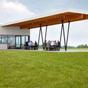
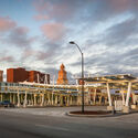
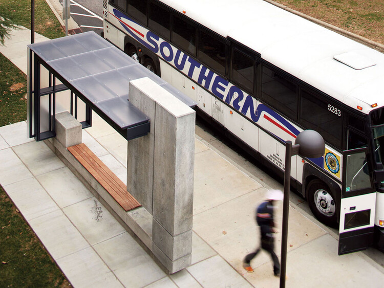
The future of transportation hubs in the United States will not be defined by iconic metropolitan airport terminals and expansive central train stations. Rural communities contain the majority of the nation's road miles, carry nearly half of all truck vehicle miles traveled, and originate two-thirds of rail freight. These realities position rural transportation hubs as vital regional access points and distribution centers that shape national mobility outside models of urban extensions.

Rural transportation hubs in the United States are essential civic and logistical anchors whose success cannot be measured against urban metrics. Instead of replicating transport hubs of dense urban typologies, designers are developing architectural models that reflect rural realities: dispersed populations, freight-dominant infrastructure, modest multimodality, safety challenges, and social access needs. In many rural regions, a modest airport terminal sustains economic viability, a rail transfer facility connects resource-based industries to national markets, and a regional bus depot provides access to employment, education, and essential services.

Rural Transportation Hubs: Infrastructure Design, Access, and Regional Mobility - Image 1 of 4Rural Transportation Hubs: Infrastructure Design, Access, and Regional Mobility - Image 2 of 4Rural Transportation Hubs: Infrastructure Design, Access, and Regional Mobility - Image 3 of 4Rural Transportation Hubs: Infrastructure Design, Access, and Regional Mobility - Image 4 of 4Rural Transportation Hubs: Infrastructure Design, Access, and Regional Mobility - More Images+ 44

Parking Garages: Antithesis or Opportunity for 21st-Century Urbanism?

Subscriber Access | 

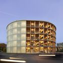
In an era of people-centered urban planning, 15-minute cities, “eyes on the street,” and active public spaces, parking garages are often seen as the antithesis of contemporary urban ideals. But that was not always the case. If today they challenge architects and planners to reinvent them in pursuit of more sustainable mobility and more human cities, in the past they stood as witnesses to a radical transformation in how we move, inhabit, and perceive urban space. Once symbols of modernity, parking garages embodied the height of an age when the automobile was seen as a driving force of progress. This shift in meaning reveals them as much more than utilitarian structures — they are powerful reflections of the evolution of urbanism, technology, and social habits over the past two centuries.

Parking Garages: Antithesis or Opportunity for 21st-Century Urbanism? - Image 1 of 4Parking Garages: Antithesis or Opportunity for 21st-Century Urbanism? - Image 2 of 4Parking Garages: Antithesis or Opportunity for 21st-Century Urbanism? - Image 3 of 4Parking Garages: Antithesis or Opportunity for 21st-Century Urbanism? - Image 4 of 4Parking Garages: Antithesis or Opportunity for 21st-Century Urbanism? - More Images+ 52

Bridging Disciplines, Connecting Cities: The Interdisciplinary Approach to Urban Mobility in Portugal

An architecture degree may provide a vast curriculum, but many of the skills needed for a project lie outside the discipline. This is especially true for urban-scale projects. They demand expertise in areas like traffic studies, structural calculations, landscape design, and technical installation forecasting. These are often seen as "complementary" but are, in fact, fundamental to the overall design.

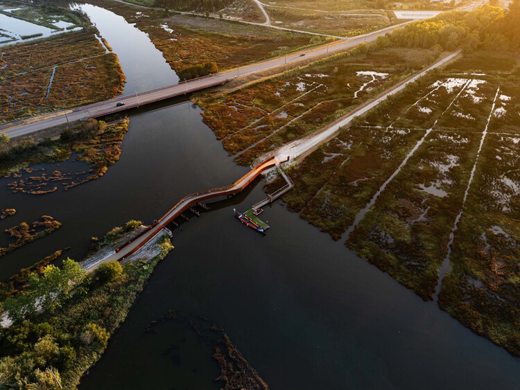
In a country like Portugal, with a relatively small but geographically diverse territory, the challenge of connecting different parts of the territory – whether to cross a river or link one level of a city to another – is a constant one. Its largest metropolitan areas, such as Lisbon and Porto, share a rugged geography of steep valleys and hills. These features led to the development of elevators and funiculars, like the Santa Justa Lift and the Bica Funicular in Lisbon, and the Guindais Funicular in Porto. Today, besides improving urban mobility, they have become tourist landmarks.

Bridging Disciplines, Connecting Cities: The Interdisciplinary Approach to Urban Mobility in Portugal - Image 1 of 4Bridging Disciplines, Connecting Cities: The Interdisciplinary Approach to Urban Mobility in Portugal - Image 2 of 4Bridging Disciplines, Connecting Cities: The Interdisciplinary Approach to Urban Mobility in Portugal - Image 3 of 4Bridging Disciplines, Connecting Cities: The Interdisciplinary Approach to Urban Mobility in Portugal - Image 4 of 4Bridging Disciplines, Connecting Cities: The Interdisciplinary Approach to Urban Mobility in Portugal - More Images+ 4

More Than Parking: 12 Projects to Reclaim Urban Space

Subscriber Access | 

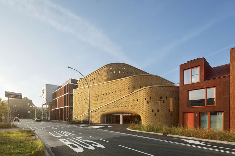
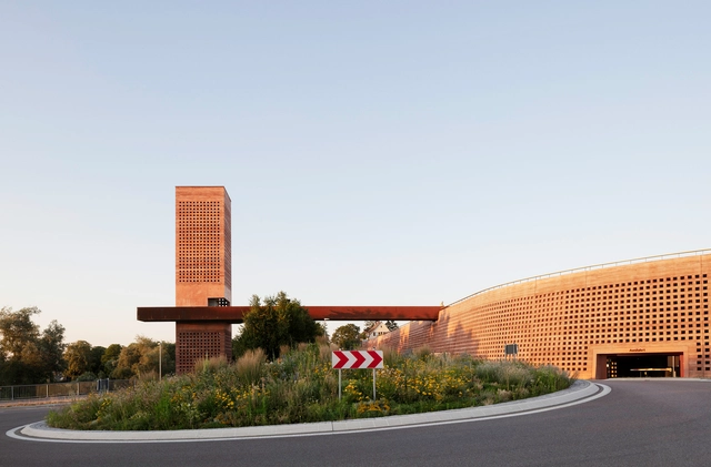
Marginalized in architectural discourse and often dismissed as purely functional, parking garages remain among the most ubiquitous structures in the urban landscape. Designed to accommodate the needs of private vehicles, they occupy central locations, shape skylines, and consume considerable resources, yet rarely receive the same attention — or architectural care — as cultural institutions, schools, or housing. Despite their prevalence, these buildings tend to fade into the background of daily life, treated as infrastructural necessities rather than as design opportunities.

This is beginning to change. As urban mobility undergoes profound transformations — from the decline of car ownership to the rise of electric vehicles and shared transport systems — the role of parking infrastructure is being redefined. Architects and planners are reimagining garages as adaptable frameworks that integrate public space, ecological functions, and mixed-use programs. These new approaches challenge the perception of parking as a residual typology and instead position it as a civic structure with the potential to support more inclusive, flexible, and sustainable urban models.

More Than Parking: 12 Projects to Reclaim Urban Space - Image 1 of 4More Than Parking: 12 Projects to Reclaim Urban Space - Image 2 of 4More Than Parking: 12 Projects to Reclaim Urban Space - Image 3 of 4More Than Parking: 12 Projects to Reclaim Urban Space - Image 4 of 4More Than Parking: 12 Projects to Reclaim Urban Space - More Images+ 26

Urban Mobility as a System: From Car-Centric to Human-Centered Cities

Subscriber Access | 

Amid the traffic-clogged arteries of Los Angeles, where cars have long ruled the streets, the future of urban mobility is being questioned. The reorientation focuses not on simply removing cars or introducing new technology, but on envisioning the city as an integrated system in which people, places, and vehicles coexist in balance. Automobiles are no longer the unquestioned centerpiece of urban life; instead, they are treated as one component of a broader, multimodal transportation network. Design now seeks to prioritize human needs and experiences over vehicular dominance.

Urban Mobility as a System: From Car-Centric to Human-Centered Cities - Imagen 1 de 4Urban Mobility as a System: From Car-Centric to Human-Centered Cities - Imagen 2 de 4Urban Mobility as a System: From Car-Centric to Human-Centered Cities - Imagen 3 de 4Urban Mobility as a System: From Car-Centric to Human-Centered Cities - Imagen 4 de 4Urban Mobility as a System: From Car-Centric to Human-Centered Cities - More Images+ 2

How Will Transportation Work in the Future? A Look at the Rise of Electric Mobility in Cities

Subscriber Access | 

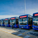
From greenhouse gas emissions and air pollution to deforestation, one of the leading contributors to global warming today is emissions from the transportation sector. Exploring its origins and evolution, as well as the major challenges it faces, the development of electric mobility in urban environments represents a global transition that requires a coordinated mix of policies and actions to achieve cleaner and more sustainable transportation systems. Designing safe and comfortable infrastructure for walking and cycling, promoting public transit and shared mobility, and designing more efficient streets that include electric vehicles, among other actions, are part of a growing worldwide effort to reduce carbon emissions.

How Will Transportation Work in the Future? A Look at the Rise of Electric Mobility in Cities - Imagem 1 de 4How Will Transportation Work in the Future? A Look at the Rise of Electric Mobility in Cities - Imagem 2 de 4How Will Transportation Work in the Future? A Look at the Rise of Electric Mobility in Cities - Imagem 3 de 4How Will Transportation Work in the Future? A Look at the Rise of Electric Mobility in Cities - Imagem 15 de 4How Will Transportation Work in the Future? A Look at the Rise of Electric Mobility in Cities - More Images+ 11

The Evolution of Gas Stations: From Roadside Stops to Architectural Landmarks

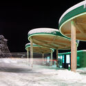
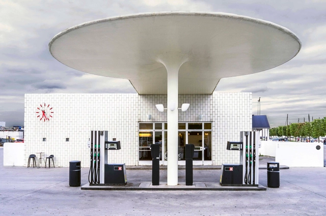
The gas station is an architectural typology that has undergone significant transformations since its inception. Initially, these structures were simple roadside refueling points designed for functionality rather than aesthetics. As automobile culture expanded, gas stations evolved to accommodate new technologies, shifting urban landscapes and changing consumer behaviors. Over time, they became more than just utilitarian stops — they developed into service hubs, integrating restaurants, motels, and leisure spaces, responding to contemporary transportation increasing demands.

By the late 20th century, however, the widespread standardization of gas stations led them to be perceived as "non-places", a concept defined by anthropologist Marc Augé to describe transient spaces that lack social or cultural significance. With uniform designs and a focus on efficiency, gas stations became interchangeable, reinforcing their role as purely functional infrastructure rather than meaningful architectural interventions. This standardization also departed from the era when fuel stations served as recognizable landmarks, contributing to a homogenized landscape devoid of local identity.

The Evolution of Gas Stations: From Roadside Stops to Architectural Landmarks - Imagen 1 de 4The Evolution of Gas Stations: From Roadside Stops to Architectural Landmarks - Imagen 2 de 4The Evolution of Gas Stations: From Roadside Stops to Architectural Landmarks - Imagen 3 de 4The Evolution of Gas Stations: From Roadside Stops to Architectural Landmarks - Imagen 4 de 4The Evolution of Gas Stations: From Roadside Stops to Architectural Landmarks - More Images+ 41

New York City Implements Traffic Congestion Pricing, the First in the US

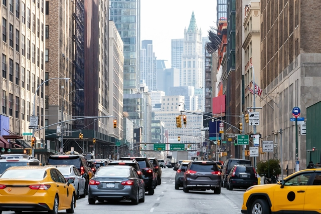
New York City has implemented the first congestion pricing scheme in the US, charging drivers up to $9 per day to enter a designated zone south of Central Park, encompassing areas like Times Square and Wall Street. The initiative aims to alleviate chronic traffic congestion, improve air quality, and generate revenue for public transportation improvements, addressing New York City's ranking as the world's most congested urban area for two consecutive years. The plan went into effect Sunday, January 5th, 2025.

New York City Implements Traffic Congestion Pricing, the First in the US - Image 1 of 4New York City Implements Traffic Congestion Pricing, the First in the US - Image 2 of 4New York City Implements Traffic Congestion Pricing, the First in the US - Image 3 of 4New York City Implements Traffic Congestion Pricing, the First in the US - Image 4 of 4New York City Implements Traffic Congestion Pricing, the First in the US - More Images

How Tech Parks Are Replacing Central Business Districts in India

Subscriber Access | 

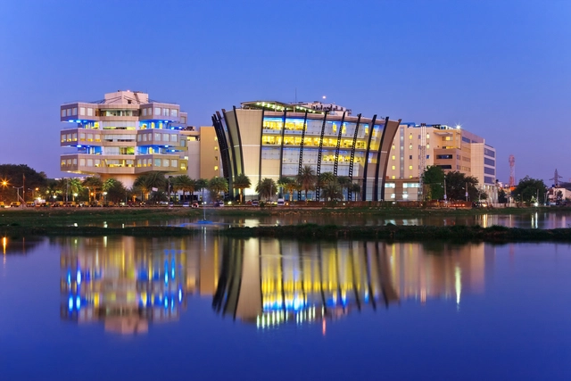
India is often recognized for its thriving technology industry, with a reputation for producing a substantial number of skilled tech professionals each year. This has attracted a dynamic technology ecosystem that increasingly draws global companies to establish operations in the country. The rise of tech parks has become a key strategy for harnessing this talent and resources, cultivating an environment conducive to innovation. What impact do these tech parks have on the urban landscape of Indian cities?

How Tech Parks Are Replacing Central Business Districts in India - 1 的图像 4How Tech Parks Are Replacing Central Business Districts in India - 2 的图像 4How Tech Parks Are Replacing Central Business Districts in India - 3 的图像 4How Tech Parks Are Replacing Central Business Districts in India - 4 的图像 4How Tech Parks Are Replacing Central Business Districts in India - More Images+ 3

Barcelona Completes First Phase of a Multiyear Renovation of La Rambla

La Rambla, a 1.2-kilometer-long promenade in Barcelona, was established in 1766 along the old city walls. Embraced by locals, it became the only spacious area for strolling in a city of narrow streets and grew into a central meeting place for all social classes. Over time, leisure and cultural sites, like the Gran Teatre del Liceu and Boqueria Market, emerged, making it a vibrant, cultural hub. In 2017, Barcelona's local government launched a competition for the revitalization of this beloved urban space. Km_ZERO, a 15-member interdisciplinary team that also relied on the input of community groups was declared the winner. Now the first phase of the urbanization process has been almost completed, led by Lola Domènech and Olga Tarrasó. A hundred trees still remain to be planted in this phase, postponed due to drought conditions. The entire project is expected to be finished in 2027.

Barcelona Completes First Phase of a Multiyear Renovation of La Rambla - Imagem 1 de 4Barcelona Completes First Phase of a Multiyear Renovation of La Rambla - Imagem 2 de 4Barcelona Completes First Phase of a Multiyear Renovation of La Rambla - Imagem 3 de 4Barcelona Completes First Phase of a Multiyear Renovation of La Rambla - Imagem 4 de 4Barcelona Completes First Phase of a Multiyear Renovation of La Rambla - More Images+ 5

Henning Larsen-Led Team Unveils Master Plan for Singapore’s North-South Corridor Urban Transformation

The team led by Henning Larsen, in collaboration with Ramboll, Cistri, Gehl, Participate in Design, and Camphora has won the commission for the master plan consultancy to design Singapore’s North-South Corridor’s surface streets. The project proposes an expansive urban transformation, aiming to integrate public transport, active mobility, community-focused spaces, and greenery along the 21.5km corridor. Local communities and stakeholders are also actively engaged in the design process through public engagement sessions. The initial master plan design is set to continue into 2026, over the next 18 months.

Henning Larsen-Led Team Unveils Master Plan for Singapore’s North-South Corridor Urban Transformation - Image 1 of 4Henning Larsen-Led Team Unveils Master Plan for Singapore’s North-South Corridor Urban Transformation - Image 2 of 4Henning Larsen-Led Team Unveils Master Plan for Singapore’s North-South Corridor Urban Transformation - Image 3 of 4Henning Larsen-Led Team Unveils Master Plan for Singapore’s North-South Corridor Urban Transformation - Image 4 of 4Henning Larsen-Led Team Unveils Master Plan for Singapore’s North-South Corridor Urban Transformation - More Images+ 2