Big Data and Urbanism: How to Organize Information for Optimal Application

Subscriber Access

Big Data refers to data that, due to its quantity and complexity, requires specific applications in order to be processed. New trends in urbanism, data collection, and management, not to mention the development of new platforms and tools, have given rise to a new era in urban analysis, creating new resources to understand, evaluate, and manage the evolution of cities.

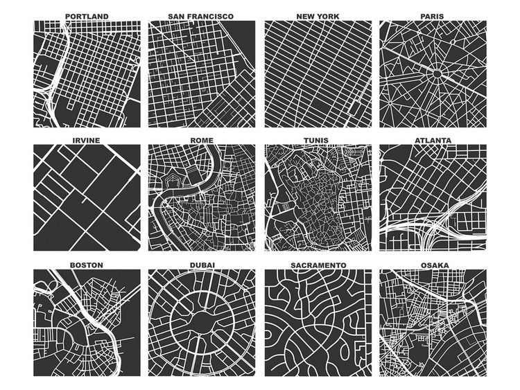
In spite of these developments, it's been a long tradition of urban planners to opt for visual methods to model cities. From Giambattista Nolli's iconographic maps of Rome to Allan Jacobs' street diagrams, visual culture has been the go-to method for urban planners to illustrate and communicate their work. Cartography especially has sought to convey the complexities of urban anatomy in a comprehensive, visual format.

Content Loader

Image gallery

See allShow less
About this author
Cite: Maiztegui, Belén. "Big Data and Urbanism: How to Organize Information for Optimal Application" [Big data y urbanismo, ¿Cómo sintetizar información compleja para su aplicación práctica?] 15 Apr 2020. ArchDaily. (Trans. Johnson, Maggie) Accessed . <https://www.archdaily.com/937054/big-data-and-urbanism-how-to-organize-information-for-optimal-application> ISSN 0719-8884

Street Networks of Every City (a square mile). The consistent spatial scale allows us to easily compare different street networks. Image © Geoff Boeing. Graphics from "Spatial Information and the Legibility of Urban Form: Big Data in Urban Morphology" Under License CC BY 4.0

大数据与城市:如何优化信息梳理过程

You've started following your first account!

Did you know?

You'll now receive updates based on what you follow! Personalize your stream and start following your favorite authors, offices and users.