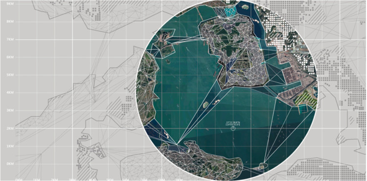
What happens when the sensor-imbued city acquires the ability to see – almost as if it had eyes? Ahead of the 2019 Shenzhen Biennale of Urbanism\Architecture (UABB), titled "Urban Interactions," ArchDaily is working with the curators of the "Eyes of the City" section at the Biennial to stimulate a discussion on how new technologies – and Artificial Intelligence in particular – might impact architecture and urban life. Here you can read the “Eyes of the City” curatorial statement by Carlo Ratti, the Politecnico di Torino and SCUT.
The recent ‘Greater Bay Area’ (GBA) initiative has led to a renewed interest in the supra-urban and regional or territorial planning scale by the spatial planning professions, urbanists and strategic spatial planners globally. The emergence of ‘mega’ urban-scapes and their regional agglomeration into urbanised areas of over 70 million – at least an order of magnitude larger than has ever been planned before - has reframed many conventional challenges of the spatial planning agenda. With the mega region in formation, a new necessity emerges, that being the investigation of the dynamic, morphogenetic and ecosystemic properties specific to specific regional conditions. Simply, the integration of eleven significantly sized cities and their corresponding metropolitan hinterlands, three special economic or administrative regions, three currencies, and three (or more) different cultural groups into one urban regional entity is a massive undertaking. At present aside from the governance and policy intentions this has primarily resulted in an infrastructural planning approach, one that utilizes a systemic top-down approach that seeks to provide the connective tissues and reticules, as well as civic and economic systems that mobilise people, capital and goods in such a vast region. This approach is akin to the smart city models which seek to enfold all aspects of civic life within infrastructure systemic control paradigms. But in reality, given the scope and scale of this undertaking the modalities of planning in the GBA need to shift from an extensive planned realm in which every part coheres to a plan, to one of a differentiated field in which different intensities arise as an effect of their urban eco-system integration (or its lack of). This clearly needs new approaches, concepts and models of planning that can deal with these regional issues in dynamic, open-ended ways that can foster new modalities of planning.
Therefore the definition of new territorial regions and scales in the GBA, exert pressure on current modernist derived approaches: in which planning methods and their instruments operating in particular ideological paradigms, seek optimised solutions for urban planometric aggregation and allocation, structural characteristics of the landscape and its aligned economic functionality, and socio-econometric models which give rise to the modern city. Such models may have structural or spatial limits, as some of the 1990s strategic spatial planning approaches for integrated cross border urban regions in the emergent EU highlighted at the time. The planning discipline therefore needs to critically reconsider its role whilst developing appropriate tools and models that are able to address current territorial challenges, whilst at the same time projecting possible future scenarios. In this light, with the challenges of new mega-regions, how or in what way would the conventional methods of spatial planning need to find adjustment or modification in their praxes? What if the conventional ways of planning become overburdened by both the scales of a planned landscape as well as the long-outdrawn processes that hamper decisions and reactionary steps of design?


