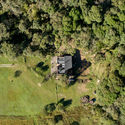
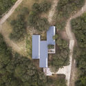
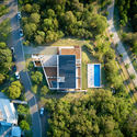
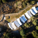

Small unmanned aerial vehicles (UAVs), commonly known as drones, have opened up new possibilities for documenting built works. Aerial photography reveals aspects of a project that are often difficult to capture from a pedestrian perspective. Much like roof plans, aerial views more clearly illustrate design decisions regarding site placement, orientation, typology, relationship with the immediate surroundings, and pre-existing structures, among other aspects.
- Related Article:
Urban Layouts: 17 Cities Seen from Above


.jpg?1617041510 "Siting Strategies and Relationship with the Surroundings: 20 Argentine Houses Seen from Above")